
The short version: Es Trenc is the long arc of white sand on Mallorca’s south coast, between Sa Ràpita and Colònia de Sant Jordi, and it sits inside a protected area, the Es Trenc–Salobrar de Campos Maritime-Terrestrial Natural Park. There are no buildings on the beach and no shade, so you bring everything and take everything back. The paid car parks at Ses Covetes and Sa Ràpita fill early in summer, August is crowded, and the people who live nearby keep Es Trenc for spring and autumn. Behind the dunes lies Es Salobrar, a wetland of salt pans where the Balearic government documents flamingos.
What Es Trenc is, and where it begins and ends
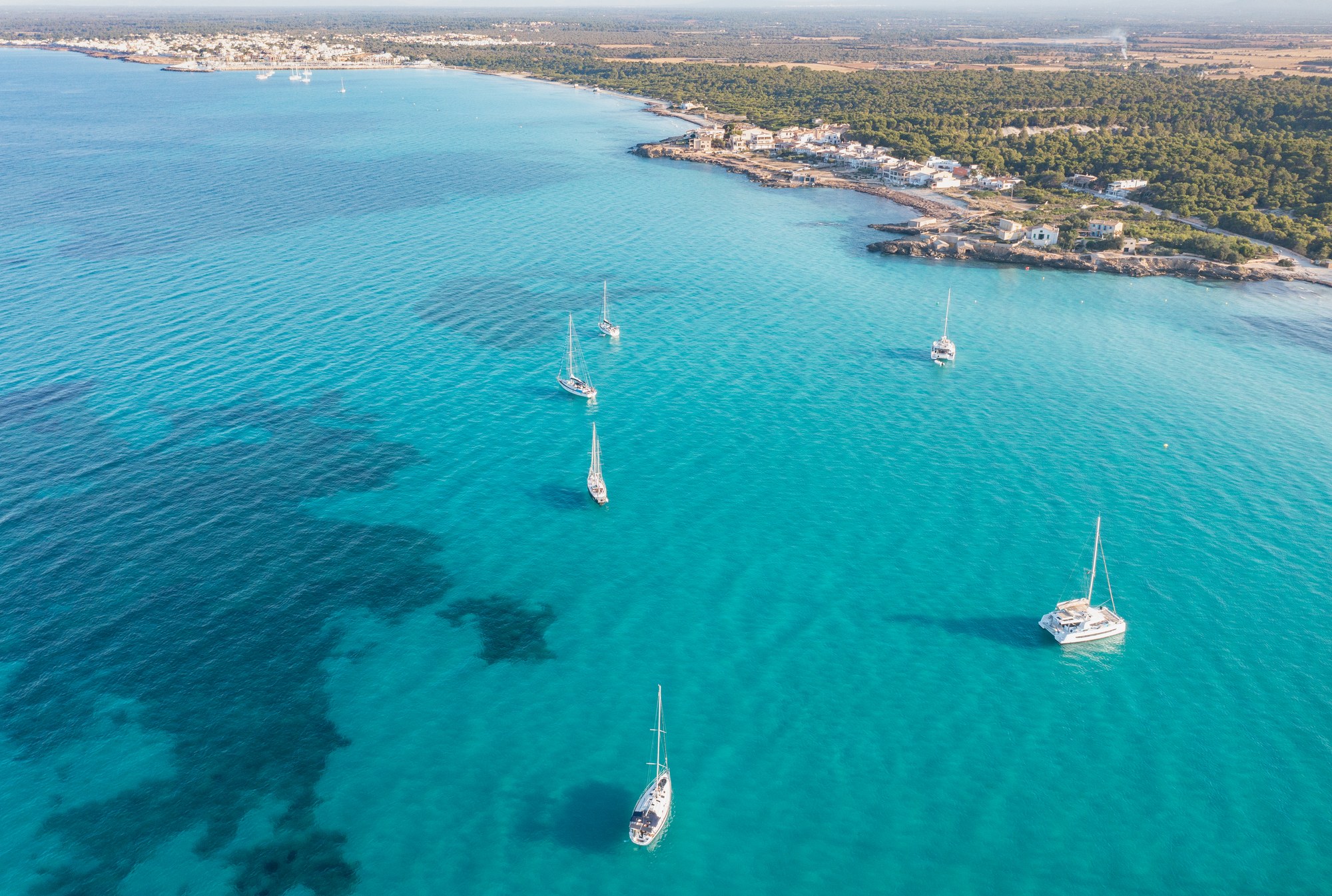
Ask where Es Trenc starts and you will get several answers. The Balearic government’s geological survey describes a beach-and-dune system about 5.6 km long (3.5 miles), shaped like an arc, running from Sa Ràpita in the north-west to Colònia de Sant Jordi in the south-east, with a short rocky stretch in the middle known as Ses Covetes (Govern de les Illes Balears, Llocs d’interès geològic). The north-western part is the Arenal de sa Ràpita; the south-eastern part is what is strictly called Es Trenc.
The Ajuntament de Campos, whose municipality the beaches belong to, names the stretches one by one: the Arenal d’en Tem, about 1,700 meters of fine white sand that is the longest beach on the Campos coast, leads into Es Trenc itself, with the small islets of Na Tirapel just offshore (Ajuntament de Campos). The Balearic tourism agency puts the beach most visitors call Es Trenc at almost 2 km long and more than 20 meters wide (Illes Balears tourism). In practice, the sand runs, with short interruptions, from one village to the other.
Ses Covetes owes its name to caves, many of them prehistoric, in a rocky rise that has since disappeared: according to the Ajuntament de Campos, it was quarried to build the Renaissance wall of Palma. Today Ses Covetes and Sa Ràpita are the usual starting points for a day on the beach.
A natural park, not a resort beach
For an American, the closest comparison is a national seashore, not a resort strip. Es Trenc and the land behind it were declared a natural park by the Balearic Parliament in 2017. The park covers 3,768 hectares (about 9,300 acres), roughly 61 percent of it at sea, and protects one of the few beach-and-dune systems still preserved on the Mallorcan coast: meadows of Posidonia seagrass under the water, lines of dunes held together by marram grass, pine and juniper woods, and the wetland of Es Salobrar (Govern de les Illes Balears, natural parks).
Entry is free and the park is open around the clock. These are the rules from its official page that shape a day here:
- Stay off the dunes and use the marked paths; no fires and no camping.
- Park only in authorized car parks and drive only on signposted roads.
- Take your rubbish with you: there are no litter bins inside the park, and waste goes in the containers of the nearby villages.
- No loudspeakers for music.
- Dogs are not allowed on the beach from March to October, both months included; from November to February they may go on the beach on a leash.
The dead Posidonia that piles up on the shore is part of the system: the government’s geological survey explains that it shields the beach and the dunes. Clothing is optional on parts of the beach, as the Balearic tourism agency notes.
Getting there: Ses Covetes, Sa Ràpita and the other accesses
The park lists four ways in: from Sa Ràpita, through Ses Covetes, from Colònia de Sant Jordi along the shore, and from the car park of Na Tirapel, which leads straight to the sand of Es Trenc. In what we see, the paid car parks at Ses Covetes and Sa Ràpita are full early on summer mornings.
Driving times from OpenStreetMap routing, in free-flowing traffic:
- From Palma (city center): about 45 minutes to Ses Covetes, around 50 km (31 miles).
- From Palma airport: about 43 minutes to Ses Covetes and 38 to Sa Ràpita.
- From Campos: about 15 minutes to Sa Ràpita and 18 to Ses Covetes or Na Tirapel.
- From Ses Salines: about 15 minutes to Na Tirapel.
- From Colònia de Sant Jordi: about 13 minutes by road to Na Tirapel, or on foot along the shore.
The park itself encourages public transport: TIB bus lines L508 and L518 reach Sa Ràpita, and line 517 reaches Colònia de Sant Jordi. Timetables change with the season; check them on the TIB website.
No buildings, no shade: bring everything
This is the part visitors underestimate. There are no hotels, no boardwalk and no shops behind the sand, which is exactly what makes Es Trenc look the way it does in the video above. It also means no natural shade and very little to buy.
According to the park, portable toilets are installed at several points of the beach during the summer months, along with an information booth by the exit of the Na Tirapel car park; in winter there is neither. The people we know who go regularly pack water, food, sun protection, their own shade and a bag for their rubbish, and treat the day as a trip into a natural area rather than a visit to a beach club.
Es Salobrar, the salt pans and the flamingos
Behind the dunes, Es Salobrar de Campos is the second-largest wetland on the island, according to the Balearic tourism agency, and the official park description lists the birds it gathers: flamingos, avocets and Kentish plovers among them. The European Natura 2000 record for the site adds that, because of its position on the south coast, it is of extraordinary importance during bird migration in both spring and autumn (Red Natura 2000, Govern de les Illes Balears). The Ajuntament de Campos counts more than 171 bird species in the protected area.
Salt is still made here. The park describes a working salt operation in Es Salobrar and a smaller one near Colònia de Sant Jordi, and the tourism agency notes that the Salines d’Es Trenc offer guided tours of the salt-making process. The surroundings of the wetland can be visited, but the park notes that the rules vary with the season.
On the beach itself, look for the old concrete bunkers built from 1939 onward. In 2014 the art collective Boa Mistura painted them white and wrote on them verses from Cala Gentil, a poem by the Mallorcan poet Miquel Costa i Llobera, according to the park. The government’s geological survey notes that the beach has retreated far enough to uncover their foundations.
When to go: spring and autumn
The people who live around Es Trenc mostly go in spring and autumn: the water is clear, the sand has room and the migrating birds are passing through. In August the beach is crowded and the car parks fill early; a summer visit works best first thing in the morning.
What residents ask of visitors
One thing bothers the people who live near Es Trenc and is easy to avoid: rubbish left behind. The park’s rules cover that and parking: park only in authorized car parks, and, with no bins inside the park, take everything back with you.
Es Trenc out of season
From November to March, Es Trenc is another place. In what we see, the beach belongs to walkers, the occasional swimmer and, under the park’s winter rule, dogs on a leash. The park has a self-guided route, Ran de mar, that follows the shoreline from Ses Covetes to Colònia de Sant Jordi, and on a calm winter day it is one of the quietest walks on the south coast. With no toilets or information booth in winter, the same rule applies: bring what you need.
Es Trenc, Colònia de Sant Jordi and Es Carbó
To the south-east, Colònia de Sant Jordi is about 5 km away, a fishing harbor with sandy beaches of its own; beyond it, Es Carbó is reached on foot along the coast. Our guide to Ses Salines and Colònia de Sant Jordi covers that side; to the north-west, Sa Ràpita and Ses Covetes belong to the farming town in our guide to Campos and Sa Ràpita. To place this coast next to the rest of the island, our guide to where to live in Mallorca covers every area.
What you need to know
Where do you park for Es Trenc?
In the authorized car parks: at Ses Covetes, at Sa Ràpita and at Na Tirapel, which leads straight to the beach. They are paid, and in summer they fill early in the morning.
Is there shade or food at Es Trenc?
There is no natural shade and there are no buildings on the beach. In summer the park installs portable toilets and an information booth; bring water, food and your own shade.
Is Es Trenc a natural park?
Yes. It is part of the Es Trenc–Salobrar de Campos Maritime-Terrestrial Natural Park, declared in 2017, which protects the beach, the dunes, the sea meadows and the Es Salobrar wetland.
Can you see flamingos at Es Trenc?
The Balearic government lists flamingos among the birds of Es Salobrar, the wetland behind the beach, along with avocets and Kentish plovers.
Can you bring a dog to Es Trenc?
Not from March to October. From November to February they may go on the beach on a leash.
Where we work
We work across Mallorca from our base in the south-east, a few minutes from Es Trenc, where you can browse homes in Santanyí, homes in Ses Salines and homes in Campos. Whatever area you are considering, contact Villas y Fincas Mallorca and we will answer in English.
Updated October 2026. Driving times come from OpenStreetMap routing and vary with traffic and season; facts about the natural park, its rules, accesses and services come from the Govern de les Illes Balears, those about the beaches from the Ajuntament de Campos and the Balearic tourism agency, all consulted in October 2026. Park rules and bus timetables can change. The descriptions reflect what we see in the south-east and are for general information only.