
The short version: north of Alcúdia’s walls, a mountainous peninsula runs out to Cap des Pinar between the bays of Alcúdia and Pollença. On it lies the public estate of La Victòria, a protected natural area crossed by signposted paths, with a sanctuary built like a fortress, the restored redoubt of Penya Rotja on its rock above the sea and the remains of the Talaia d’Alcúdia, the watchtower on the summit. This is its story, told from official sources.
A peninsula between two bays
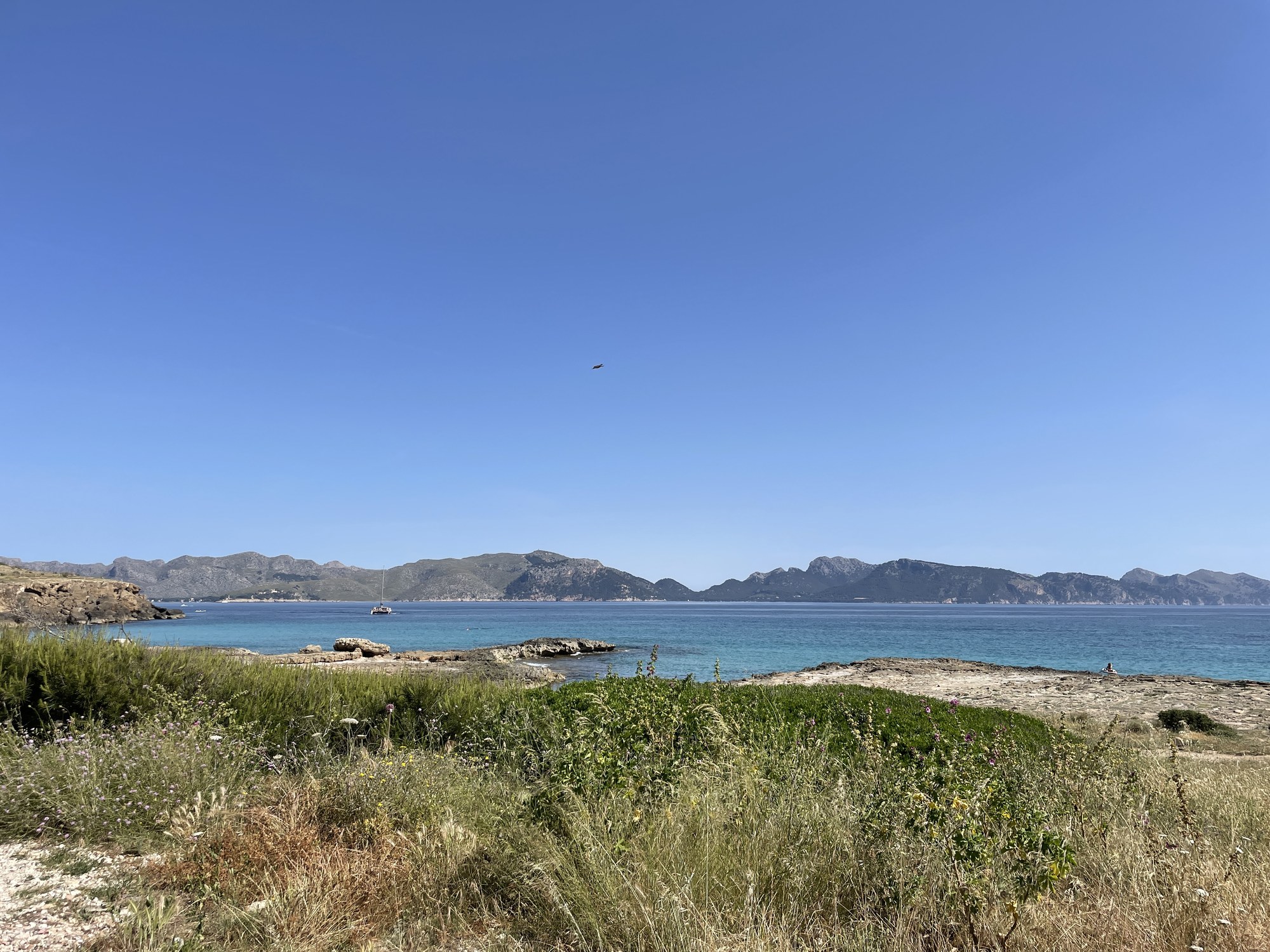
Our guide to Alcúdia and Port d’Alcúdia covers the walled town, the port and the quiet side facing Pollença. According to the Balearic Institute of Nature (IBANAT), the public estate of La Victòria lies in the north of the municipality and stretches out to Cap des Pinar. It covers 1,384 quarterades, the traditional Mallorcan land measure, protected as an Area of Special Natural Interest. IBANAT names its landmarks: the Talaia d’Alcúdia, the Puig Romaní, the Penya Roja and a string of coves, from s’Illot and Cala Solana to the beach of es Coll Baix.
The land has a working past. The Consell de Mallorca, in its walk to the Talaia d’Alcúdia, explains that these were the communal lands of La Victòria, where the people of Alcúdia gathered wood and dwarf palm, sowed and hunted to sustain a precarious economy. Today the Consell counts the peninsula among Mallorca’s main natural spaces, with broad pine woods and slopes shaped by centuries of use, fire and grazing.
A sanctuary built like a fortress
The road onto the peninsula climbs to the sanctuary of the Mare de Déu de la Victòria, where most walks begin. The Ajuntament d’Alcúdia’s catalogue of historic and artistic heritage dates the present building to the 17th and 18th centuries and notes that a place of worship may already have stood here in the 13th. It describes a tall rectangular block that seems more a fortress than an oratory: thick walls with no openings at ground level apart from the two doorways, and windows only in the upper part, where they lit the cells of those who lived there. The Government’s tourism site, illesbalears.travel, gives an older origin: a Baroque hermitage built in the 14th century and refurbished around the 18th.
The story of the image is older than the walls. The Consell’s walking guide tells it this way: at the beginning of the 14th century a shepherd boy found an image of the Virgin at the place now called Ses Tres Creus. It was carried to Alcúdia, and it returned by itself to the same spot, never to leave again. Later a hermit and alchemist, Friar Diego Garcia, settled nearby, and the image became famous when the city’s defenders called upon it during the Germanies, the 16th-century revolt.
Raiders at S’Illot
The fortified look had its reasons. The same Consell guide records that in 1684 raiders landed at S’Illot, the cove beside the road up to the sanctuary, overcame what it calls the ferocious defense of the local people and entered the chapel. They cut off the right arm of the image of Jesus and carried off the ornaments and valuables. In September 1735 a second attack seriously damaged the interior, including the Gothic image of the Virgin, which had to be restored.
Penya Rotja: a redoubt on the rock
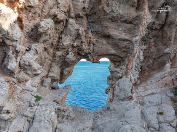
The coast was watched from above. On a massive rock above the sea, at the place the maps call the Penya del Migdia, stands the redoubt known as Penya Roja or Penya Rotja. The town hall’s heritage catalogue dates it to 1603, gives it protection grade A and lists what survives: a tall stone wall sheltering the enclosure from the north-west wind, with the entrance gate set into it; a small house for the tower keepers, usually two; a rainwater cistern; and two batteries, one high and one low, where the cannons were placed, together with the watchtower. There is also a mid-18th-century oven, which the catalogue says seems to have been built to heat cannonballs red-hot, although another theory holds it was a bread oven; either way, it was never used. The redoubt has been restored.
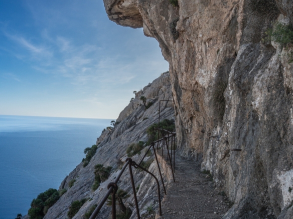
Alcúdia’s tourism office describes the walk on its page for the Ermita de la Victòria route: from the sanctuary, a narrow path climbs to a trail along the coast that reaches the foot of the Penya del Migdia after 3 kilometers, and about 15 more minutes lead to the summit, with a view over the bay of Pollença and Cap de Formentor and, on the clearest days, Menorca.
The Talaia: the highest watchtower
The redoubt could not see everything. According to the Consell’s guide, the Jurors of Alcúdia ordered a second tower in the 16th century, on the summit, to watch the part of the bay not visible from the Penya Roja. The heritage catalogue calls it the highest of the towers built in Mallorca and, citing the local historian Pedro Ventanyol, dates the start of the work to 1567, under the master stonemason Sebastià Terrassa. Hard to supply with stone and water, it came out weak and was patched many times. A watchman, the talaier, lived there.
The Government’s tourism site explains how it worked: the coastal towers warned of danger from the sea, such as pirates, with smoke by day and fire by night, and this one also signaled to the city of Alcúdia by waving banners on a pole. The Consell describes a circular tower almost six meters across, exposed to storms and lightning; both the Consell and the town hall record that it survived into the 20th century. Today its remains crown the summit, with, a little lower down, two huts where soldiers sheltered during the Civil War.
Walking the peninsula
The Consell’s route to the summit is a loop from the sanctuary car park. It follows the forest track to the Pla de sa Talaia, where a bridle path, the Pas de s’Aritja, leads to the top, then turns south over the Puig des Boc to the Collet des Coll Baix and returns along a stream, past the pools of Ses Fontanelles and the large wild olive trees of the Coll de na Benet. The Consell lists it at 10,206 meters, 3 hours 48 minutes and 598 meters of ascent, grades it medium and marks it as not suitable for children under six, strollers or wheelchairs.
Longer versions start in the old town. The tourism office’s route brochure grades the walk from Alcúdia to the sanctuary and its summits as moderate, and the route through the fields to the Coll Baix and up to the Talaia as difficult. Its hiking page notes that most of the municipality’s trails can be walked at any time of year.
Es Coll Baix: the beach at the end of the path
The other destination is the sea. The tourism office’s page for El Coll Baix explains that the beach is reached by a path of some difficulty, with spectacular scenery on the way down; its brochure adds that the beach is accessible only on foot and that the track fades toward the end, where care is needed.
At the col stands a small refuge. IBANAT explains that it belongs to the Ajuntament d’Alcúdia, opened in 2008 as part of the Balearic Government’s network of refuges, sleeps six and is booked through IBANAT.
Pine, wild olive and dwarf palm
IBANAT describes woods of Aleppo pine and wild olive, foxglove and dragon arum among the notable plants, and one of the corners of the island where the dwarf fan palm, the tall càrritx grass and cotton lavender are most abundant. Beyond them, the view runs across the bay to the cliffs of Formentor and to Pollença and its port.
Before you set out
The Balearic Government’s emergency service, SEIB 112, publishes its advice for mountain hiking in safety: check the forecast, never go alone, tell someone your route and return time, carry water, food, a charged phone and a flashlight, wear footwear that supports the ankle, stay on the path, watch for rockfalls and never light a fire in the woods. In an emergency, call 112. Walkers can also register their itinerary for excursion tracking.
What you need to know
Where is Penya Rotja?
On the La Victòria peninsula in Alcúdia, on the rock the maps call the Penya del Migdia. The tourism office describes a path from the sanctuary of La Victòria along the coast to its foot and then up to the summit.
What is on top of Penya Rotja?
A restored redoubt dated 1603 by the Ajuntament d’Alcúdia: a wall with an entrance gate, the keepers’ house, a cistern, an 18th-century oven, two cannon batteries and a watchtower.
How long is the walk from the Ermita de la Victòria to the Talaia d’Alcúdia?
The Consell de Mallorca’s loop from the sanctuary over the Talaia and the Coll Baix covers 10,206 meters in about 3 hours 48 minutes, graded medium.
Can you walk to Es Coll Baix beach?
Yes, and only on foot. The tourism office describes the path down as one of some difficulty, and its brochure warns that the track fades near the end.
Is the La Victòria peninsula public land?
The public estate of La Victòria, on the peninsula and out to Cap des Pinar, is protected as an Area of Special Natural Interest, according to the Balearic Institute of Nature (IBANAT).
Where we work
We work across Mallorca from our base in the south-east: homes in Santanyí, homes in Ses Salines and homes in Campos. To compare the north with the rest of the island, see our guide on where to live in Mallorca, or contact Villas y Fincas Mallorca and we will answer in English.
Updated October 2026. History, routes and descriptions come from the Ajuntament d’Alcúdia (catalogue of historic and artistic heritage, approved in 2007) and its tourism office (route pages and brochure), the Consell de Mallorca (family walk to the Talaia d’Alcúdia and its guide), the Balearic Government (IBANAT, the tourism site illesbalears.travel and SEIB 112), all consulted in October 2026. Distances, times and grades are those published by each source; paths and access can change, so check them before setting out. This story is for general information only.