
The short version: Cala Bona is the small harbor of Son Servera, on Mallorca’s north-east coast, where the long beach of Cala Millor ends and the coast turns rocky toward Costa dels Pins. A dozen fishing families once lived here with their boats in a natural harbor; today the same harbor, run by the Balearic port authority, holds recreational boats, a fishing quay and the excursion boats that leave from its quay. Around it there are three small sheltered beaches, a seafront walk that continues from Cala Millor, and small coves farther north. This story tells how Cala Bona became what it is, from the town hall’s and the port authority’s records and from what anyone can see on a walk along the water.
Where Cala Bona sits
On the map, Cala Bona looks like the northern tip of Cala Millor, and on foot it feels that way too. Administratively it belongs to Son Servera. The Balearic Government’s tourism site describes Son Servera as a municipality in the north-east of Mallorca whose coast includes Cala Bona, Port Verd, Port Nou, Port Vell, Costa dels Pins and the well-known resort of Cala Millor. Cala Millor itself is shared: according to the Ajuntament de Son Servera, its beach of more than two kilometers belongs to two municipalities, Sant Llorenç des Cardassar and Son Servera.
The town of Son Servera stands a short drive inland, and for most of its history it looked to the land rather than the sea. The town hall’s history of the municipality explains that its economy was based on agriculture, livestock and, to a lesser extent, fishing, and that during the 20th century it became one of the island’s tourist centers. Cala Bona is where that smaller, seafaring part of the story lived.
A dozen fishing families and a natural harbor
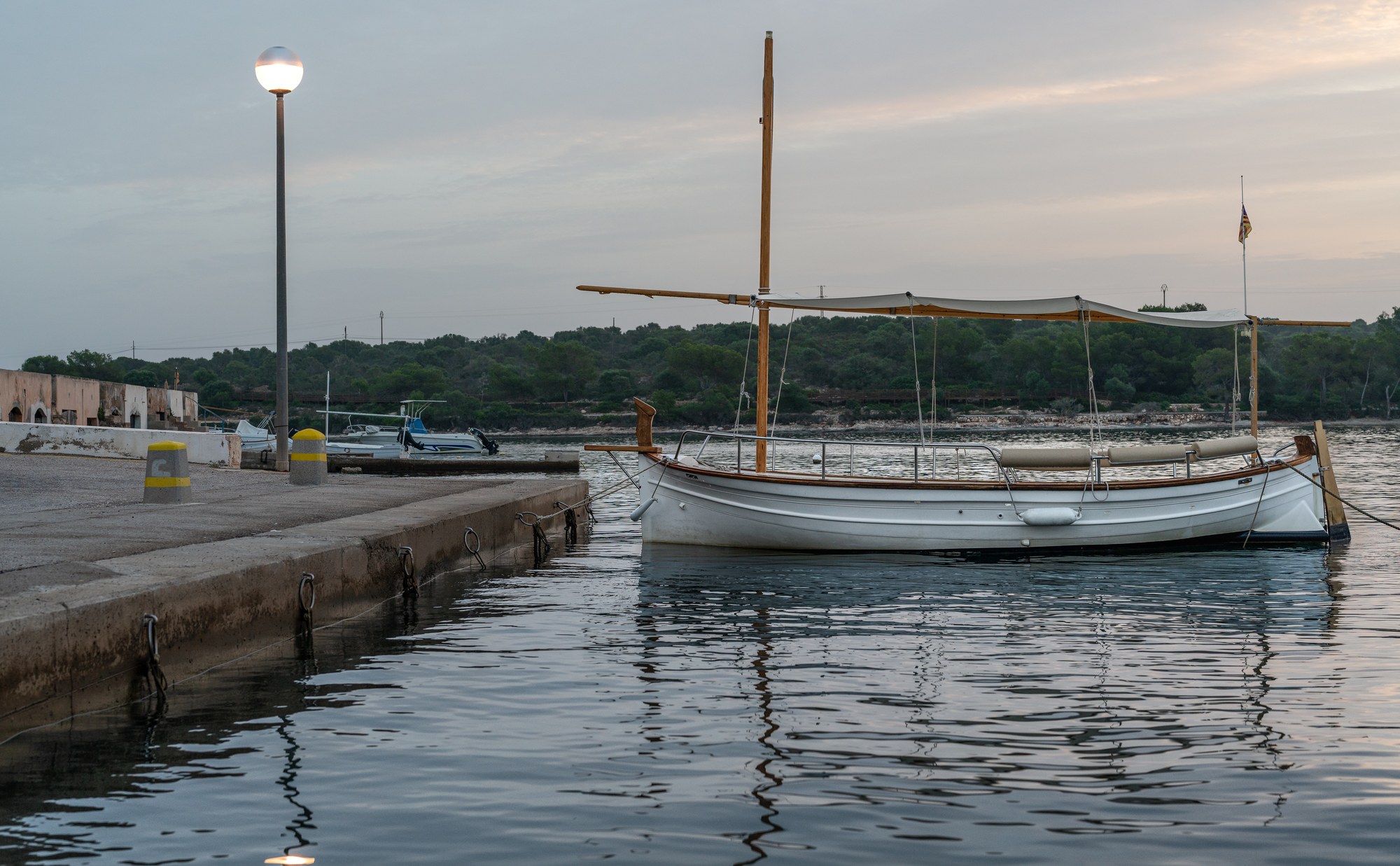
The town hall’s page on Cala Bona tells the beginning in a few lines. In the early days, about a dozen fishermen lived at the harbor with their families, and fishing was their only livelihood. Their llaüts, the traditional Mallorcan wooden fishing boats, were anchored nearby in a natural harbor, and on the rocks above the water they kept their lobster pens.
Nearby stood a guesthouse, a fonda, built in 1924. There was no electricity yet. At night, by the light of a pressure lamp, fishermen and summer visitors played dominoes and talked outside the fonda. Years later, the town hall’s account continues, the fonda became the Hotel Cala Bona, and the steady growth of tourism brought new hotels to Cala Bona and the enlargement of the harbor to make room for fishing boats and leisure craft.
The port authority dates the harbor’s own story to the same years. According to Ports IB, the port’s origins go back to 1934, when a fishing community existed in the area and used modest facilities; the first port works were built to serve that community.
From fishing harbor to the port you see today
What began as shelter for a few boats is now a port with a clear shape. Ports IB describes the classic layout of a breakwater and a counter-breakwater, both of rock, which enclose the original facilities, now the inner harbor. Two floating docks and a pier divide the water, and boats also tie up along the quays. In its description, the port has 192 berths for boats of different lengths, 20 of them for visiting boats, and the authority manages it directly. Fishing traffic, the same page says, is now a small part of its activity: the port’s main function is to serve recreational boats. Its list of facilities still includes a fishing quay, a fish market and the fishermen’s guild.
The Balearic Government sums up its role in the same terms. When it declared the project to recover the harbor’s depths an investment of regional interest, in June 2024, the agreement published in the Balearic official gazette, the BOIB, described Cala Bona as a port facility dedicated to recreational boating, fishing and tourist excursion boats, and as an old port that had gradually lost depth over the years. The project plans dredging of the basin so that boats can use the harbor safely.
The town hall still presents the harbor as a fishing harbor. Its page on Cala Bona Port calls Cala Bona a fishing village next to Cala Millor whose small harbor still retains the charm of times gone by, and its beach page pictures the fishermen sewing their nets while visitors walk around the quay.
The walk along the water
The easiest way to understand Cala Bona is to walk into it from Cala Millor. The seafront path runs north from the long beach, past hotels and terraces, and reaches the harbor without a single climb. The town hall describes Cala Millor’s six flat kilometers as made for cycling, and the video above follows exactly that route, with a cycle lane running through the resort and people out walking and cycling on a spring morning.
On the way, the character of the coast changes. Cala Millor is one long open beach; Cala Bona is built around a harbor, and the last stretch of the walk is a line of restaurants and cafés facing the boats. The town hall places the start of tourism in Cala Millor in the late 1950s and early 1960s; Cala Bona filled with hotels too, but the harbor kept its place at the center of the village.
Three small beaches and the coves to the north
Cala Bona’s beach is not a single strip of sand. According to the Ajuntament de Son Servera, the beach is 550 meters long and 9 meters wide, has a first-aid service, and before the harbor there are three artificial beaches, very well maintained. They are small, sheltered and right beside the promenade.
The town hall has also certified Cala Bona beach for universal accessibility. Its accessibility page explains that the beach holds the AENOR certificate under the UNE 170001 standard and offers an assisted bathing service from 10 am to 5 pm between May 1 and October 31, booked at least 24 hours in advance.
North of the harbor, the coast becomes rockier and more residential. The town hall names the beaches nearby: Sa Punta Roja, the closest to the harbor, and, toward Costa dels Pins, the beaches of Port Verd, Port Nou and Port Vell, small coves that it describes as places for those looking for calm. Farther along, the Costa dels Pins viewpoint has its own small tradition: its railing carries hundreds of padlocks left by couples who have pledged to stay together and thrown the key into the sea.
Boats out of the harbor
For many visitors, the quay at Cala Bona is a point of departure. The town hall notes that glass-bottom boats, which let passengers look at the seabed, leave from the end of Cala Millor beach and from the harbor of Cala Bona, and that a company in the harbor organizes diving and snorkeling trips. Ports IB lists a passenger boat station and ticket sales among the port’s facilities, and the Balearic gazette records that in 2023 the port authority granted a concession for a tourist information office in the port. In the video, filmed in late April, the excursion catamarans are already coming and going from the quay.
The sixteenth of July
One day a year, the harbor returns to the fishermen. According to the town hall, July 16 is the feast of the patron saint of Cala Bona and of its fishermen, the Mare de Déu del Carme, Our Lady of Mount Carmel, when all the boats, decorated for the occasion, go out to sea to honor her. It is the day when the village’s oldest trade takes to the water in front of everyone.
Son Servera, behind the coast
The town itself lies a short drive inland. The Government’s tourism site describes the weekly local produce market on Fridays, when Plaça de Sant Joan fills with residents and visitors, and the Església Nova, an unfinished church with no roof, open to the sky, designed by Joan Rubió, a disciple of Gaudí, where religious and cultural events are held. It also mentions a green route for walkers and cyclists along the old railway line that linked Manacor and Artà. Farther north along the coast, Artà, Cala Ratjada and Canyamel have their own story in our guide to Artà, Cala Ratjada and Canyamel.
What you need to know
Where is Cala Bona in Mallorca?
On the north-east coast, in the municipality of Son Servera, at the northern end of Cala Millor and next to Costa dels Pins.
Is Cala Bona part of Cala Millor?
No. It is a separate village of Son Servera, joined to Cala Millor by the seafront walk. Cala Millor’s beach is shared by Son Servera and Sant Llorenç des Cardassar.
Who runs the port of Cala Bona?
Ports IB, the Balearic port authority, which manages it directly. It serves recreational boats, fishing and tourist excursion boats.
What is the beach like in Cala Bona?
Three small artificial beaches beside the promenade, with a first-aid service and a certified accessible beach point offering assisted bathing from May to October.
When is the fishermen’s feast in Cala Bona?
On July 16, the feast of the Mare de Déu del Carme, when the decorated boats go out to sea, according to the Ajuntament de Son Servera.
Where we work
We work across Mallorca from our base in the south-east, where you can browse homes in Santanyí, homes in Ses Salines and homes in Campos. To compare areas across the island, see our guide on where to live in Mallorca, or contact Villas y Fincas Mallorca and we will answer in English.
Updated October 2026. History, figures and dates come from the Ajuntament de Son Servera, Ports IB, the Balearic official gazette (BOIB, 2023 and 2024) and the Government’s tourism site illesbalears.travel, all consulted in October 2026. Services and schedules can change; this story is for general information only.